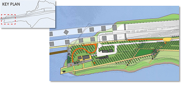
proposed park plan: park areas
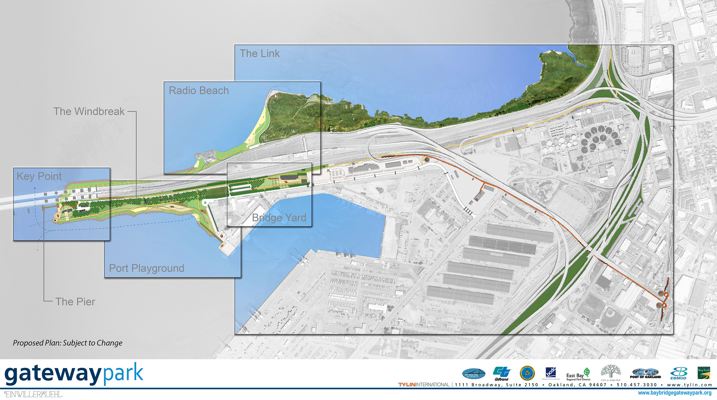
The new park covers approximately 170 acres. The linear park would extend from the waterfront near the touchdown of the new East Span of the Bay Bridge to Mandela Parkway in West Oakland, and would extend under Interstate 880 and the I-80/I-880/I-580 freeway maze. The park’s site plan is subdivided into six areas.
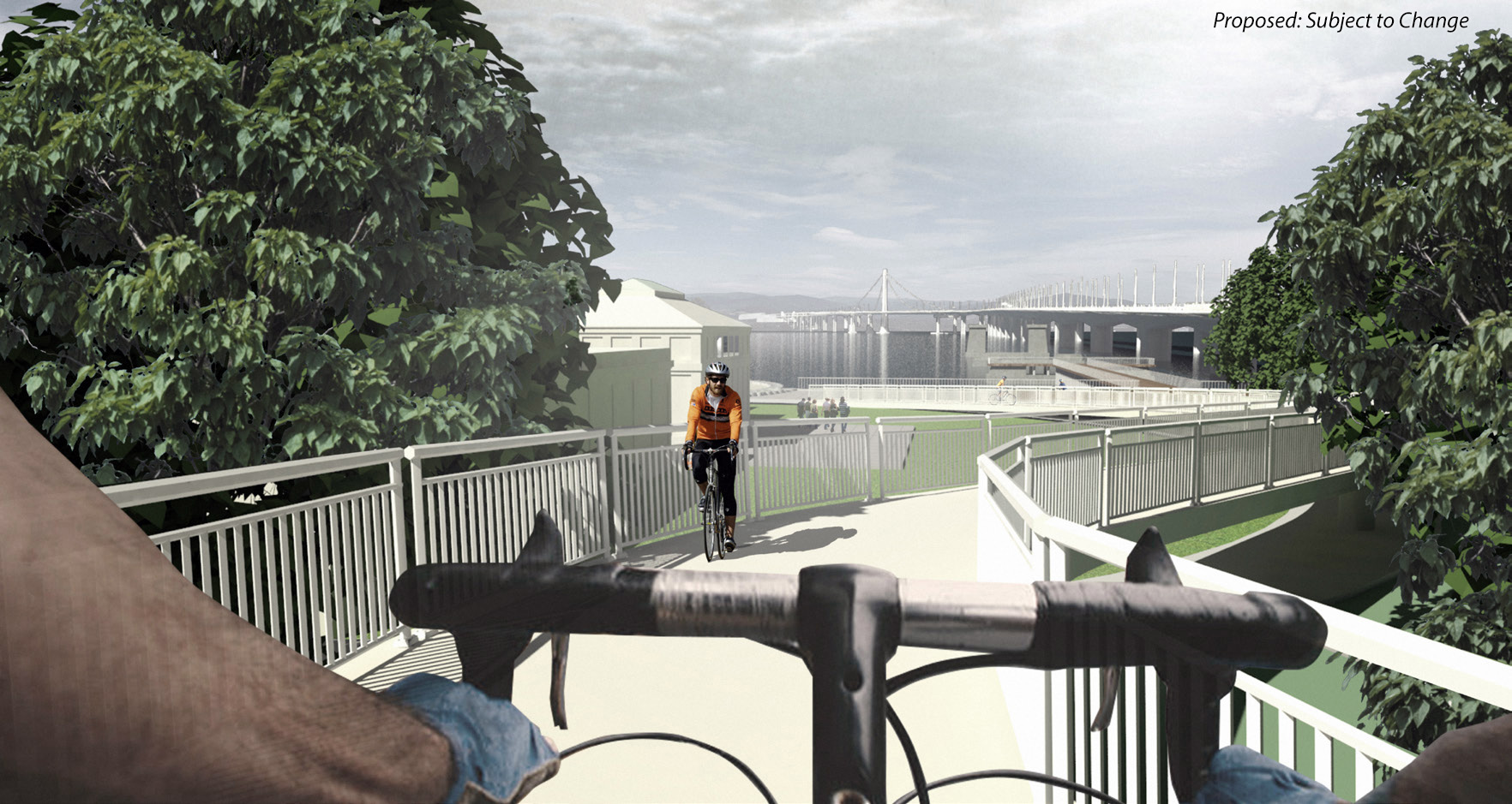
The Link (SFOBB Oakland Bicycle-Pedestrian Connection)
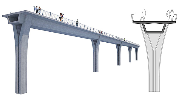
The Link provides safe access to the park and the Bay Bridge with a new bicycle/pedestrian path extending 6,000 linear feet from Mandela Parkway in West Oakland to the Bay Bridge Trail. This eastern location at Mandela Parkway is the confluence of three major bicycle routes within Oakland and a connection to the San Francisco Bay Trail. The Class I path is an elevated structure, with a maximum grade of five percent, for most of this distance to provide access across existing freeways, railways and industrial areas.
In addition to the new elevated path, project features could include:
- Way finding elements, which may include old Bay Bridge artifacts (to help guide users to the park)
- A connection to the recently completed at-grade bicycle/pedestrian path from Emeryville to Maritime Street
- A 100-space overflow parking lot at Wood Street
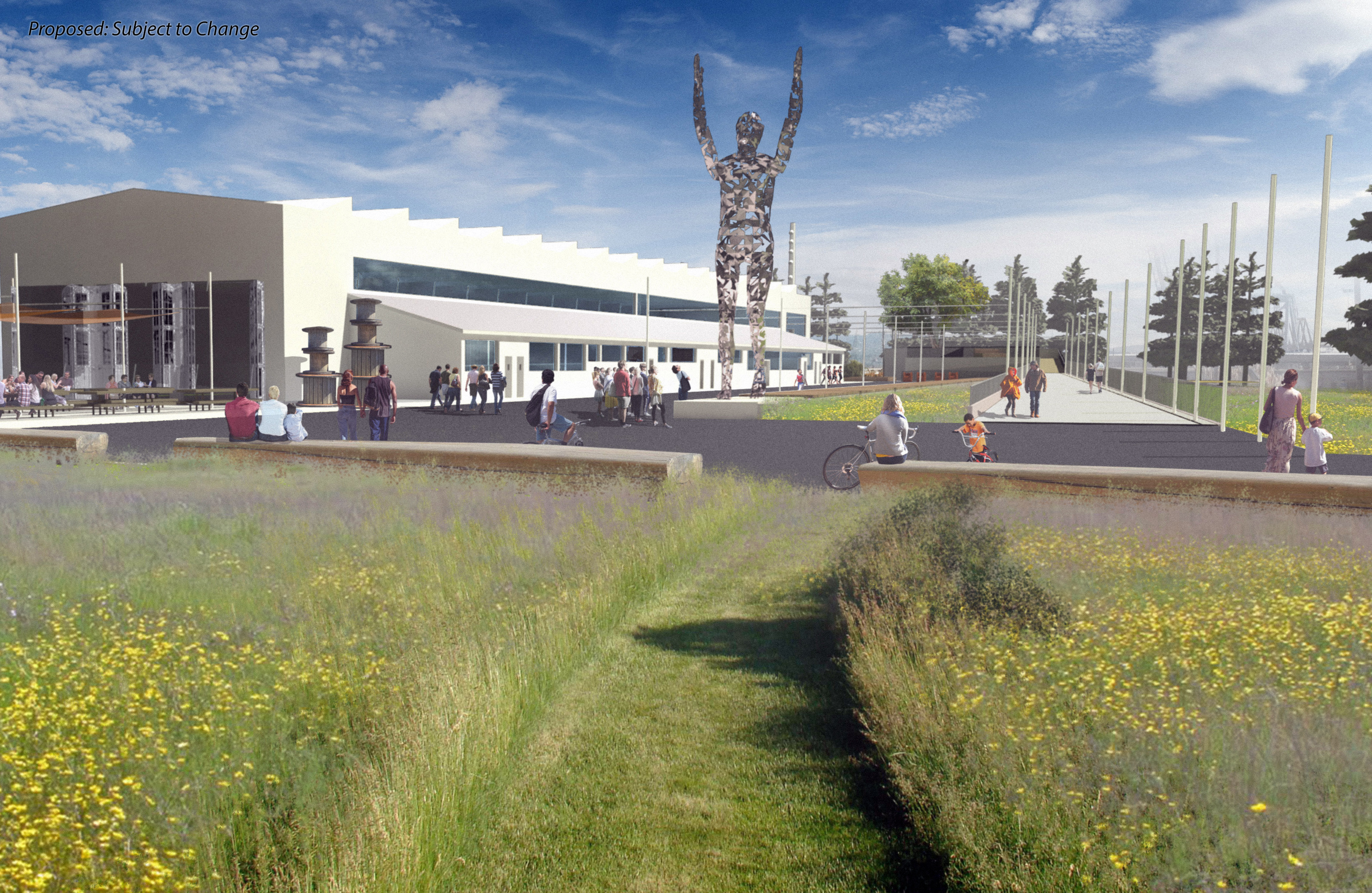
The Bridge Yard
The Bridge Yard is a destination recreation and event center. It provides a flexible space for a variety of park activities and programs while reusing existing site elements. It includes an arrival area, parking, event space and recreation uses. Events at the Bridge Yard could include art displays, movies, concerts, corporate carnivals and parties.
Project features include:
- Arrival plaza for bicycles, cars, buses and transit
- Two parking lots
- Display area for historic trains
- Outdoor Yard event space for small gatherings to large events
At a later date, the project could also include:
- New indoor/outdoor auditorium (embedded into the landscape) for approximately 100-200 people, located adjacent to the Bridge Yard Shop.
Port Playground
The Port Playground is a destination for active and passive recreation along the shoreline. It includes a new visitor center; play areas for children, teenagers and adults; kayak launch and storage; a beach; and a boardwalk with picnic and observation areas.
Project features include:
- New visitor center that would integrate bike storage, kayak storage and climbing wall
- Fitness and children’s playground and possibly an area to serve as an extreme sports playground (e.g., street style parks for skateboards and BMX bikes)
- Sandy beach and kayak launch
- Boardwalk with observation and picnic areas
- View ride(s), such as elevated zip line, ropes course, elevated chair ride or Ferris wheel
- Parking
- Provisions for a temporary food area (i.e., food trucks and carts)
- Shoreline protection through a combination of natural and gently graded slope, riprap and walls to provide for habitat enhancement and protection of critical facilities
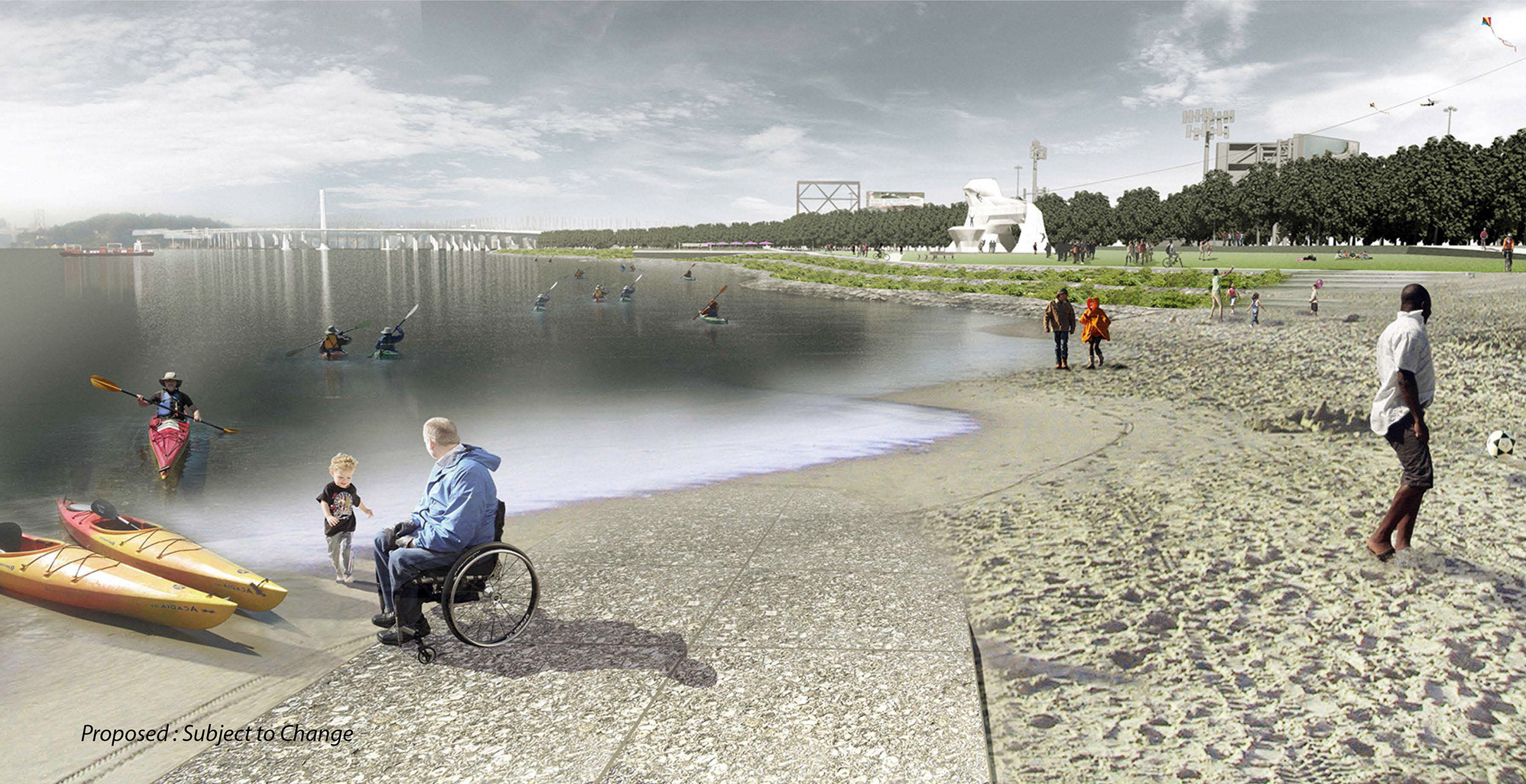
Artist rendering of the kayak beach, climbing wall
Key Point + The Pier
The Key Point, at the west end of the park, would be the landing for bicycle and pedestrian traffic from the Bay Bridge, and will emphasize nature (tide pools, lawns, restoration planting, outdoor classroom). It also would acknowledge the transportation history of the Bay, including the Key electric train system and the Bay Bridge, with an industrial circular theme.
The Pier would be a 300-foot long structure extending west into the Bay along the alignment of the old Bay Bridge. It would provide an area for visitors to fish and view the Bay, and it could include a fish-cleaning station.
Project features include:
- Renovation of existing structures
- Ecology tidal pools
- Pier extending 300 feet into the Bay along the old Bay Bridge alignment
- Levee trail and elevated path to connect to the Port Playground area to the bicycle/pedestrian path on the Bay Bridge. The levee path would also extend beneath the Bay Bridge to Radio Beach.
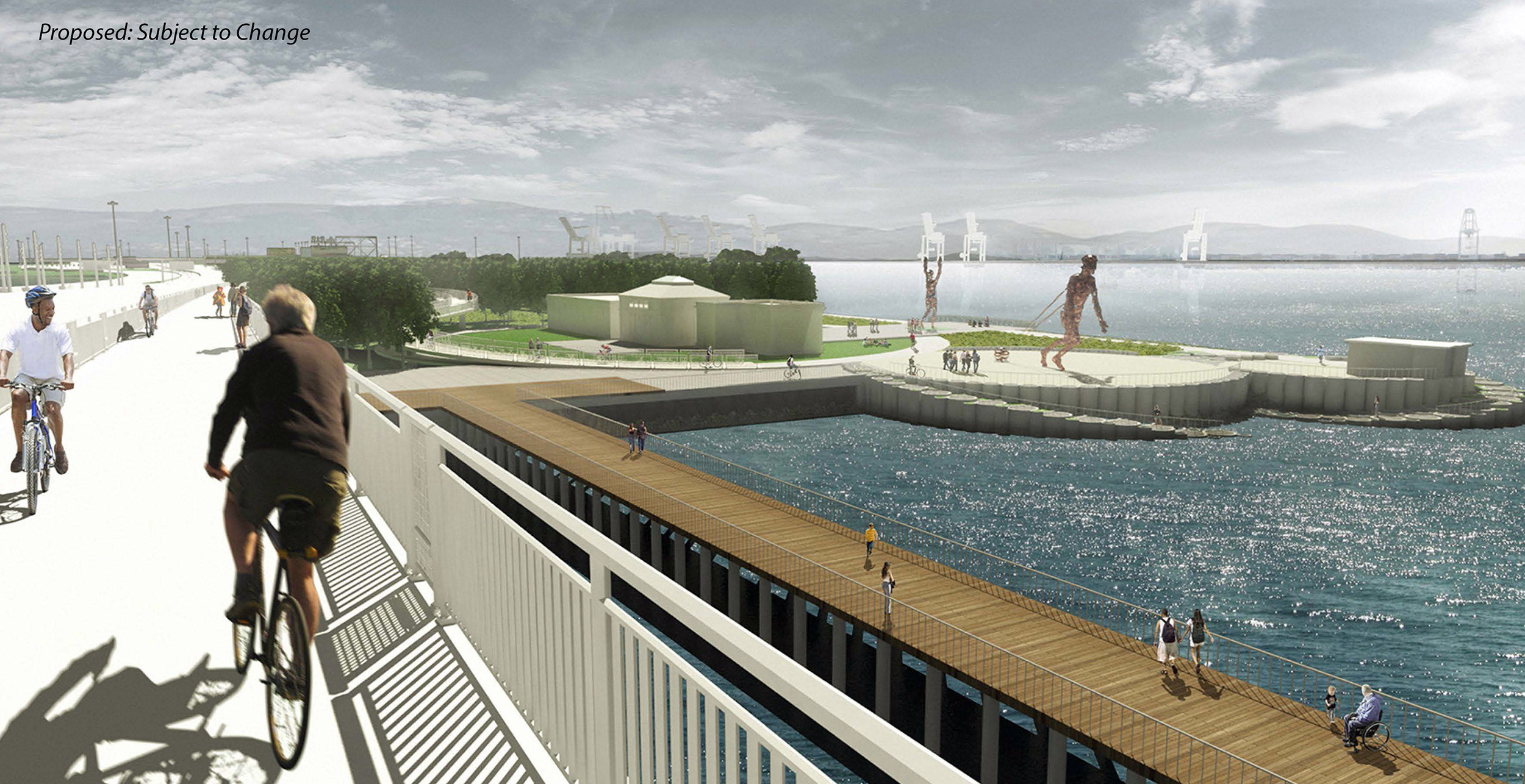
Artist rendering of the bike path connection to the Bay Bridge, a fishing pier, artificial tidepools
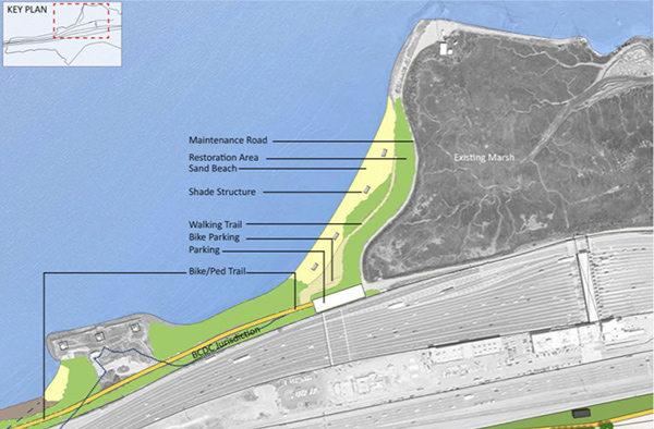
Radio Beach
Radio Beach is a restoration and preservation area with limited, passive recreation (e.g., interpretive walking trails, sandy beaches) and fencing to protect wildlife. Radio Beach is the only area of the proposed park located on the north side of I-80. It would be connected to the rest of the park with a trail extending under the Bay Bridge.
Project features include:
- Levee trail extending from Key Point under the Bay Bridge to the eastern end of Radio Beach to provide access and long-term protection against sea level rise
- Restoration planting and habitat enhancement
- Ecological interpretation signage along the levee trail and beaches
- Fencing to protect wildlife and the environmentally-sensitive existing tidal marsh area.
The existing vehicular access roads and informal parking areas would not be modified by the project
Wind Break (The Lungs)
Wind Break represents the vegetated buffers that would be installed between I-80 and the core park area. Vegetation would be planted throughout the park to block and diffuse vehicular air emissions.
![]()